Geography
Geography Curriculum Rationale
At Hadrian Primary we are geographers! We want our children to love geography. We want them to have no limits to what their ambitions are and grow up wanting to be cartographers, town planners, conservationists or weather forecasters. We want them to embody our core values, “Be Unique: Believe, Achieve, Succeed Together.” The geography curriculum has been carefully crafted so that our children develop their geographical capital. We want our children to remember their geography lessons in our school, to cherish these memories and embrace the geographic opportunities they are presented with!

Intent

Our geography curriculum promotes curiosity and a love and thirst for learning. It is ambitious and empowers our children to become independent and resilient – like all curriculum areas.
We want to equip them with not only the minimum statutory requirements of the geography National Curriculum but to prepare them for the opportunities, responsibilities and experiences of later life.
We want our children to use the history, cultural diversity and vibrancy of our local area and town - South Shields. Our children are given the opportunities to learn from other cultures, respect diversity, co-operate with one another and appreciate what they have. We achieve this by providing a strong SMSC curriculum, with British Values and our core values placed at the heart of everything we do. This often feeds into the geography curriculum. Children in Year 6 are currently working in partnership with Asda, Fareshare and Re:Think Food to create an Eco-Shop. They are selling surplus foods from their local supermarket to not only help feed their community but to help tackle the impact that food waste has on the environment. The children are aware of climate change and are playing their part in creating a change.


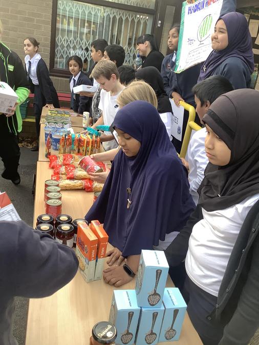
The staff at Hadrian are committed to ensuring that children grow up to be citizens who are conscious of the environment they live in and understand the steps they can take to make a positive impact on the world. Hadrian has been named as an eco school and we even have our very own pupil eco council who work to ensure our school is as environmentally friendly as possible. From EYFS children learn about important issues such as how to recycle. During COP26 the entire school created a tree of promises. Children wrote a promise on each leaf as to how they would protect their planet.

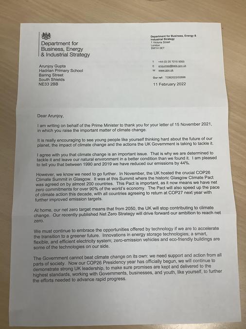
Children also wrote “Letters to the Earth’ during COP26. They thought about what they would say to the Earth if they were given a chance or what they would say to our current world leaders. The children really impressed us with their passionate letters and Arunjoy in Year Six wrote a particularly powerful letter. We sent it to 10 Downing Street so the Prime Minister could read it - Arunjoy was delighted when he received a reply.


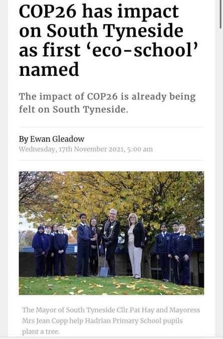
To symbolise our commitment to improving the environment we were joined by the mayoress to plant a tree in our school grounds. She stated that:
“It is inspirational to see the enthusiasm and concern these young people have for the planet. They care very much for the environment and it is wonderful to see how keen they have been to learn about COP26.” The Mayor of South Tyneside (2021)
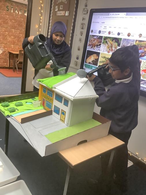
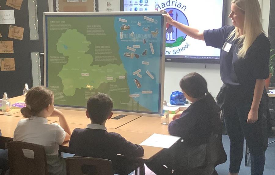
As a school we are lucky to be situated in an area that is ideally located for geographical fieldwork. We are located at the mouth of the River Tyne and are a short walk away from the North East coastline. We can even explore our local area from a different perspective with the help of our school drone. We have been working closely with Tyne Rivers Trust to learn more about the river, how to stay safe near water and how to conserve water to help protect our environment.

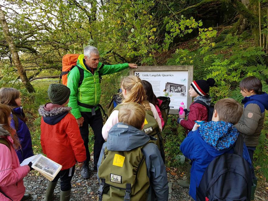
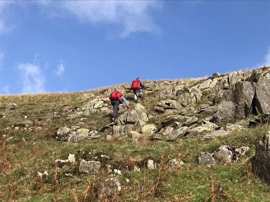
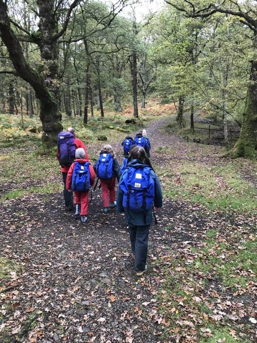
At Hadrian we aim to enrich our pupils time here with memorable, unforgettable experiences and provide opportunities which may normally be out of reach - this piques their interests and passions. We take annual trips to Thurston OEC in the beautiful Lake District which not only allows children to develop their geographical knowledge and skills but also provides them with memories they will cherish for a lifetime.


Implementation
A high-quality geography education should inspire in pupils a curiosity and fascination about the world and its people that will remain with them for the rest of their lives. Teaching should equip pupils with knowledge about diverse places, people, resources and natural and human environments, together with a deep understanding of the Earth’s key physical and human processes. As pupils progress, their growing knowledge about the world should help them to deepen their understanding of the interaction between physical and human processes, and of the formation and use of landscapes and environments.

Our geography curriculum has been carefully built to ensure progression and repetition in terms of embedding key learning, knowledge and skills. Within each year group, geography strands are revisited in a progressive manner. We ensure that children steadily build their human and physical geographical knowledge, place and location knowledge and their geographical skills including map skills and fieldwork skills.

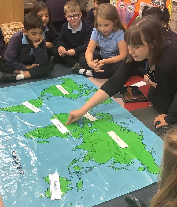
For example, in KS1 children will be able to locate the UK and the 7 continents using a map of the world. As their knowledge progresses in KS2 children will use maps with greater skill: using a variety of maps e.g. topographical, OS grid etc, locating human and physical features.

We empower our staff to organise their own year group curriculum under the guidance of our subject leaders. Teachers are best placed to make these judgements. Staff develop year group specific long-term curriculum maps which identify when the different subjects and topics will be taught across the academic year. The vast majority of subjects are taught discretely but staff make meaningful links across subjects. They link prior knowledge to new learning to deepen children’s learning. For example, in Year 5, children create an information text in English. Children linked their informational writing to current climate issues and then created a video informing viewers of the impact climate change is having on polar bears in the Arctic. To inspire their learning further, the class adopted a polar bear through WWF and enjoy receiving regular updates.

Geography in EYFS
In EYFS, Geography is known as “The World” element of the “Understanding of the World” goal in the Early Years Framework (2021). At Hadrian our children begin to develop their geographical knowledge by exploring features of our school and nursery. Physical maps, interactive maps and first atlases are used to investigate different places as we begin to compare and contrast different environments. During continuous provision, children make maps for a purpose and have experience creating maps after inputs eg, making farm feature birds eye view maps and creating treasure maps. Children at Hadrian have rich opportunities to make use of school grounds to enhance and apply their skills as geographers such as our “Fresh Air Fridays”, where children access the outdoor classroom, the allotment, the trim trail and trips further afield. Throughout the year, children observe and discuss the weather and seasonal changes on our daily weather chart as well as having opportunities to learn about celebrations in society and which countries these celebrations originated. Children also learn about the different jobs which people do in our community and discuss their future aspirations.
Our Curriculum Overview

 Impact

Our Geography curriculum is high quality, well thought out and is planned to demonstrate progression. We then assess each unit against the National Curriculum Objectives in computing using Target Tracker.
We can monitor which skills in all three elements of geography by highlighting the skills in which the children have mastered using Target Tracker. This also enables us to plan in intervention or clubs to support those children who are not meeting the standards, but it can also inform us, as a school, who are the children which are excelling in geography and they can be pushed to the next stage and become members of our 'Hadrian Eco Council'.
Assessment information is collected frequently and analysed as part of our monitoring cycle. This process provides an accurate and comprehensive understanding of the quality of education in geography. A comprehensive monitoring cycle is developed at the beginning of each academic year. This identifies when monitoring is undertaken. Monitoring in geography includes: work sampling, lesson observations and/or learning walks, pupil/parent and/or staff voice.
All of this information is gathered and reviewed. It is used to inform further curriculum developments and provision is adapted accordingly.
By the end of their time at Hadrian, children should feel confident in using geographical skills. Children will have a sound understanding of the world around them and their place within it. Children will leave Hadrian ready for the future!
Ultimately, children will leave Hadrian as Geographers!
Geography National Curriculum
Key stage 1:
Pupils should develop knowledge about the world, the United Kingdom and their locality. They should understand basic subject-specific vocabulary relating to human and physical geography and begin to use geographical skills, including first-hand observation, to enhance their locational awareness.
Pupils should be taught to:
Locational knowledge
- name and locate the world’s seven continents and five oceans
- name, locate and identify characteristics of the four countries and capital cities of the United Kingdom and its surrounding seas
Place knowledge
- understand geographical similarities and differences through studying the human and physical geography of a small area of the United Kingdom, and of a small area in a contrasting non-European country Human and physical geography
- identify seasonal and daily weather patterns in the United Kingdom and the location of hot and cold areas of the world in relation to the Equator and the North and South Poles
- use basic geographical vocabulary to refer to:
- key physical features, including: beach, cliff, coast, forest, hill, mountain, sea, ocean, river, soil, valley, vegetation, season and weather
- key human features, including: city, town, village, factory, farm, house, office, port, harbour and shop
Geographical skills and fieldwork
- use world maps, atlases and globes to identify the United Kingdom and its countries, as well as the countries, continents and oceans studied at this key stage
- use simple compass directions (North, South, East and West) and locational and directional language [for example, near and far; left and right], to describe the location of features and routes on a map Geography – key stages 1 and 2 3
- use aerial photographs and plan perspectives to recognise landmarks and basic human and physical features; devise a simple map; and use and construct basic symbols in a key
- use simple fieldwork and observational skills to study the geography of their school and its grounds and the key human and physical features of its surrounding environment.
Key stage 2:
Pupils should extend their knowledge and understanding beyond the local area to include the United Kingdom and Europe, North and South America. This will include the location and characteristics of a range of the world’s most significant human and physical features. They should develop their use of geographical knowledge, understanding and skills to enhance their locational and place knowledge.
Pupils should be taught to:
Locational knowledge
- locate the world’s countries, using maps to focus on Europe (including the location of Russia) and North and South America, concentrating on their environmental regions, key physical and human characteristics, countries, and major cities
- name and locate counties and cities of the United Kingdom, geographical regions and their identifying human and physical characteristics, key topographical features (including hills, mountains, coasts and rivers), and land-use patterns; and understand how some of these aspects have changed over time
- identify the position and significance of latitude, longitude, Equator, Northern Hemisphere, Southern Hemisphere, the Tropics of Cancer and Capricorn, Arctic and Antarctic Circle, the Prime/Greenwich Meridian and time zones (including day and night)
Place knowledge
- understand geographical similarities and differences through the study of human and physical geography of a region of the United Kingdom, a region in a European country, and a region within North or South America Human and physical geography
- describe and understand key aspects of:
- physical geography, including: climate zones, biomes and vegetation belts, rivers, mountains, volcanoes and earthquakes, and the water cycle
- human geography, including: types of settlement and land use, economic activity including trade links, and the distribution of natural resources including energy, food, minerals and water Geography – key stages 1 and 2 4
Geographical skills and fieldwork
- use maps, atlases, globes and digital/computer mapping to locate countries and describe features studied
- use the eight points of a compass, four and six-figure grid references, symbols and key (including the use of Ordnance Survey maps) to build their knowledge of the United Kingdom and the wider world
- use fieldwork to observe, measure, record and present the human and physical features in the local area using a range of methods, including sketch maps, plans and graphs, and digital technologies
